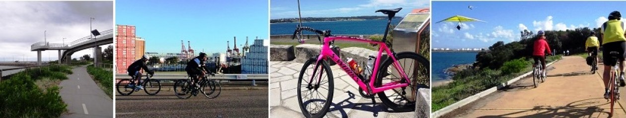
 Excerpts from Chapters 1-4 (Responses made to Key Stakeholders on Cycling)
and further below the excerpts are from Chapter 5 responses to community on cycling as well as Climate Change
Issue description – cycleway adjacent to rail corridor Rockdale City
Council has requested that the proponent commit to the construction of a commuter cycleway adjacent to the rail corridor between Kingsgrove and Mascot, as promised as part of the M5 East Motorway project.
Response
The project would enhance cycling infrastructure and connectivity at the western and eastern ends of the project (refer Section 5.5.2 of this report). The project would be in tunnel from the western tunnel portals in Kingsgrove to the eastern ramp portals located at the St Peters interchange, precluding cycling infrastructure along this section of the project. The project does not propose to construct surface infrastructure between the western and eastern tunnel portals. Existing cycle links are provided along the local street network in this area. The provision of additional cycling infrastructure is not part of the project scope, and would not contribute to meeting the project objectives articulated in Chapter 3 of the EIS. Extending the existing cycleway along Wolli Creek Valley to connect the western and eastern cycle infrastructure was investigated as part of the M5 East Motorway project. That investigation identified that a cycleway at this location would not be feasible as it would require additional land acquisition.
Issue description – pedestrian and cycle connectivity
The majority of the pedestrian / cycle amenity improvements are provided in the St Peters area where the level of traffic impact is expected to be greatest. As the New M5 project contains no access points within the Rockdale local government area and is tunnelled for its entire length, there is little opportunity to introduce new pedestrian/cycle facilities as part of the project. Agreements were in place as part of the M5 East project to construct a shared path along the railway corridor adjacent to the M5 East. This commitment was never fulfilled and Council has been left with an indirect and lower quality cycle network in this area. The issue of the M5 East project not undertaking the cycle project should now be addressed as part of this project as it currently is a significant missing link in the regional cycle network. Council also should begin to liaise with the Sydney Motorway Corporation / Roads and Maritime to discuss required cycle facilities in the Southern Gateway Connection and the F6 Connection to President Avenue. There is a strong need for improved cycle networks parallel to this corridor as well as improvements to the east-west connections providing improved connections from the residential/business centres to the west to the residential/recreational areas to the east. The Cooks Cove foreshore areas are a major attractor for recreational cycling. As Wolli Creek, Cooks Cove, Arncliffe and Banksia continue to grow as Priority Precincts it would be important to establish good regional cycle networks to provide this connectivity.
Response
The project would enhance cycling infrastructure and connectivity at the western and eastern ends of the project (refer Section 5.5.2 of this report). The project would be in tunnel from the western tunnel portals in Kingsgrove to the eastern ramp portals located at the St Peters interchange, precluding cycling infrastructure along this section of the project. The project does not propose to construct surface infrastructure between the western and eastern tunnel portals. Existing cycle links are provided along the local street network in this area. Extending the existing cycleway along Wolli Creek Valley to connect the western and eastern cycle infrastructure was investigated as part of the M5 East Motorway project. The investigation identified that a cycleway at this location would not be feasible, as it would require additional land acquisition. Roads and Maritime Services would consult Rockdale City Council on the development of plans for future projects in the area.
Issue description – pedestrian and cycle impacts during construction
Council should be consulted in relation to significant changes proposed for existing pedestrian and cycling infrastructure during the construction phase. In particular, the Bourke Road cycleway diversion is not acceptable and in relation to pedestrian facilities, the proponent will need to follow all Marrickville and City of Sydney council policies including appropriate, accessible paths of travel during construction.
Response
Cyclists are recognised as an important group of stakeholders, and their specific needs will be considered during detailed design and implementation of the project. Particular attention would be given to areas where existing cycling facilities would be directly affected by construction works, such as along Bourke Road. Any changes to existing cycling infrastructure, including mechanisms to communicate these changes to affected stakeholders would be documented in the Construction Traffic and Access Management Plan for the project. Temporary diversions to active transport routes would be minimised wherever reasonable and feasible, however some diversions would be required over the course of the project to maintain the safety of all road users including motorists, cyclists and pedestrians. Marrickville Council is a key stakeholder and would be consulted on all proposed temporary and permanent changes to active transport facilities and routes during planning and construction.
Issue description – pedestrian / cycle connectivity during operation
No pedestrian/cycling study has been undertaken for the EIS, and it is expected that the EIS would go further than it has to identify opportunities for walk/cycle network improvements and how these can be integrated with the surrounding network. Council note that the project involves the upgrade of a number of intersections with traffic lights. These upgrades should be undertaken in a way that maximises pedestrian access and safety through minimising the spatial area of intersections, minimising crossing lengths, giving pedestrians priority in traffic light phasing and minimising provision of left-turn slip lanes for traffic. Provision is made for a bridge connecting the raised cyclist and pedestrian bridge from the southern of Campbell Road and Sydney Park. An at-grade solution on the northern side of Campbell Street would be a more logical solution in developing the regional cycle network. The project proposes the installation of exclusive on-road cycling facilities along Campbell Street, which is supported in principle. Concern is raised at the provision of an above- ground cycleway and pedestrian path/bridge on the south side of Campbell Street, as it does not include emergency access, rest spaces, shade or adequate connections to local streets. It is recommended that conditions of approval for the project include options for an at-grade cycle way instead of the proposed elevated structure to address the above concerns about the elevated path. Council supports the proposed two-way cycleway along northern side of Campbell Street, but notes it stops at the intersection of Campbell and May Streets, St Peters. Council requests links to all existing cycleway be provided, including a link across the Bedwin Road bridge. One of the four traffic lanes on the Bedwin Street bridge should be removed to provide a suitable walk/cycle connection over the bridge.
Response
Pedestrian and cycle connectivity has also been raised by TTM Consulting, who were engaged by Marrickville to prepare a report commenting on the traffic related components of the EIS. Further discussion of pedestrian and cyclist impacts is presented in Section 4.17 of this report. The New M5 Main Works Contract proposes a St Peters Interchange (the “Project”). The concept plan proposes various cycleways, shared paths and footpaths as part of the Project. Throughout the Project development, Active Transport has been a key consideration in the development of the concept plan and Scope of Works and Technical Criteria (SWTC) requirements. However, as part of the submission a further review has been undertaken. In summary, the review has included: A review of the municipal and state active transport strategies and show the initiatives in Saint Peter’s Interchange region (including a brief review of current and future projects). A review of: The current Active Transport network (highlighting current deficiencies/areas for network improvement); The proposed Active Transport network (resulting from the Project) noting the improvements; and Future opportunities resulting from the project. Comment on the consistency in Strategy of the Project with surrounding strategies outlined in Section 1. Compare the standard of Active Transport (in terms of bicycle and shared path dimensions) as required under the Project (SWTC) to the paths already constructed in the surrounding municipalities. Other risks associated with Active Transport Projects. The active transport infrastructure to be implemented as part of the project would improve connectivity for cyclists and pedestrians via provision of a more integrated network. Pedestrian and/ or cyclist connectivity outcomes resulting from the project and includes: At the western end of the project, the existing M5 Linear Park shared path would be upgraded to provide a three metre wide surface for the majority of its length (around two kilometres in total) Providing a pedestrian and cycle friendly east / west connection to Bourke Road from Campbell Road through an additional crossing of the Alexandra Canal (currently an approximately 3.5km gap in connectivity) Providing a further connection along Bourke Street near Church Avenue at Mascot, integrating into the Alexandria Canal cycleway and improving the north to south connection on separated paths Improved connections to bike friendly paths (north of Sydney Park) at Mitchell Road through shared paths along Euston Road and Sydney Park Road at St Peters Improved connections from Campbell Road to Simpson Park and Camdenville Park at St Peters with new separated paths Improved pedestrian permeability to Sydney Park and the open space created by the New M5. Providing a connection to Canal Road from Sydney Park / Campbell Road through a shared path Improved connections into King Street at Newtown from the improvements to the network to the south A change to one-way traffic on Barwon Park Road (left turn from Campbell Road) resulting in reduced traffic flow and increasing the potential cycle use of the road. A key benefit for cyclists and pedestrians stems from the separation of motor vehicles and cyclists/pedestrians via provision of a dedicated network of paths.
Issue description – design of footpaths and cycleways
The project description and the diagrams do not adequately state the width of footpaths and cycleways. It is necessary to design adequately for bike and foot traffic as per Austroads requirements. At present, the road infrastructure is provided at above minimum levels, whereas the pedestrian and cycle infrastructure is at minimums or less. It would be wise for the Government to consider and engage with its own policy to adequately provide for these growing road user groups. The Government’s cycling policy, Sydney’s Cycling Future, promises “bicycles will be incorporated into the delivery of transport projects” and “Bicycle facilities will be identified and delivered parallel to major transport corridors”, yet this project has only included bicycle facilities at each end, not along the length of the corridor. The project should be required to fulfil Government policy to deliver a parallel active transport corridor, just as previous projects, such as the M7 and the Lane Cove Tunnel, did.
Response
Pedestrian and cycle infrastructure would be designed and constructed in line with applicable standards and guidelines, including Austroad design guidelines. The local surface road upgrades associated with the project would provide improved access and travel for active transport modes, including cycling. The new and upgraded pedestrian and cycling infrastructure would improve the safety and connectivity by providing a regional cycle connection between Mascot and Marrickville. Existing dedicated cycleways are provided either side of the M5 East Motorway from beyond King Georges Road through to Kingsgrove Avenue. Cyclists can also access a combination of dedicated cycling lanes and bicycle friendly roads as identified by Sydney Cycleways, parallel to the New M5, between Beverley Hills and the Sydney CBD. The project does not propose to construct surface infrastructure between the western and eastern tunnel portals. Existing cycle links are provided along the local street network in this area. Extending the existing cycleway along Wolli Creek Valley to connect the western and eastern cycle infrastructure would be constrained, as a cycleway through this area would require additional land acquisition.
Issue description – road configuration
The diagrams at Figure 5-34 and 5-37 do not match in terms of road configuration, and do not give details regarding intended widths for traffic lanes and the pedestrian and cycling facilities. The proponent must advise which is the correct diagram and the widths of traffic lanes and the walking and cycling facilities and state how the design complies with Austroads. As with road design pedestrian and cycle facilities should be designed for growth and functionality rather than to the minimum requirement.
Response
The Council’s position is noted. The Campbell Road bridge over the Alexandra Canal provides for two lanes of traffic in each direction divided with a raised median, and footpaths would be provided on each side of the bridge to provide at-grade pedestrian connectivity between Bourke and Burrows Roads. The cross section of Campbell Road would increase in width on the bridge approaches to develop turning lanes for the intersections either side. The traffic lanes would generally be three metres wide with kerbside lanes at 3.5 metres. A separate and dedicated pedestrian and cycle bridge would also be provided over Alexandra Canal at this location. This bridge would have a separated cycle and pedestrian paths with widths of 2.5 metres and 1.5metres respectively plus clearances. All pathways would be designed with reference to Austroads, the NSW Bicycle Guidelines and existing pedestrian and cycle paths within the precinct, and path widths would confirmed during detailed design. The City of Sydney, Marrickville Council and Botany Council are key stakeholders and would be consulted on active transport facilities and routes during planning and construction.
Issue description – signage
In section 5.8.6 it is stated that all signage will be clear and unambiguous for motorists. Not all road users are contained within a vehicle, and road signage must cater for all road users, including pedestrians and bike riders. Signage will be especially important in helping riders to navigate regional cycling routes, especially as new routes are introduced. This section also states that directional signage will send traffic heading to the City and Randwick via Euston Road. However, it is not clear what the intended paths of travel are on Euston Road toward the city centre. It should be expected, given desire lines, that city-bound traffic would head along Euston Road/McEvoy Street then north on Wyndham Street or Botany Road. Roads and Maritime Services is already aware of the significant congestion along this route in the AM and PM peaks. This confirms the City’s concerns that the New M5 is intended to service the city and the east, and inadequate traffic modelling has been done to fully understand the impacts of the New M5. For traffic heading towards Randwick, the two paths are either via Lachlan Street (which is already congested, particularly on weekends) or O’Dea Avenue via Bourke Road (also significantly congested, particularly at weekends).
There is also a lack of clarity about what other paths of travel the unreleased demand as identified in the traffic model output will take. It is highly likely that this traffic will disperse onto local streets such as Mitchell Road or potentially Bourke Road via Huntley Street.
Response
A signage strategy would be developed during the detailed design of the project. In relation to desire lines and paths of travel to be adopted by unreleased demand, the route choices within the EIS network model are subject to the normal limitations inherent in strategic models of this nature. These models are more accurate on major roads than on local roads and are a necessary approximation to allow coverage of the entire Sydney road network. The model has been calibrated to 2012 traffic volumes to take account of anticipated travel patterns across Sydney using a wide range of route choice behaviour. Although it may have some difficulty in representing traffic distribution in local street systems, it is considered suitable for use in this EIS.
Issue description – active transport during construction
The proponent would need to work with Councils and the Transport cluster’s active transport teams to identify how bike riders would be serviced during construction, particularly along the Bourke Road cycleway. The City’s position is that bicycles are human-powered and more vulnerable road users, therefore they need to retain their existing path of travel during construction. This usually takes the form of dedicating the traffic lane that would otherwise be used by motorised traffic to bike riders. Vehicles that are motorised are to be diverted instead as the impact of a detour is less significant. The City has followed this approach during construction projects for many years. This cycle route has built strong ridership and use continues to grow, particularly as Mascot Town Centre is built; and this ridership needs to be maintained safely, throughout the construction period.
Response
Cyclists are recognised as an important group of stakeholders, and their specific needs would be considered during detailed design and implementation of the project. Particular attention would be given to areas where existing cycling facilities would be directly affected by construction works, such as along Bourke Road. Any changes to existing cycling infrastructure, including mechanisms to communicate these changes to affected stakeholders would be documented in the Construction Traffic and Access Management Plan for the project. Temporary diversions from existing active transport routes would be minimised wherever reasonable and feasible, however some diversions would be required over the course of the project to maintain the safety of all road users including motorists, active transport and the public.
Issue description – Campbell Road pedestrian and cycle bridge to Sydney Park (design)
It is appreciated that this cycleway is intended to provide a fully separated path connecting Sydney Park to the Bourke Road cycleway and Mascot Town Centre. However, an elevated shared facility on a regional cycle route may not be the optimal design. As stated in the EIS, the bridge would become one of the longest pedestrian bridges in NSW. The bridge would be just four metres wide between the integrated pedestrian handrails and throw screen, allowing for a 1.5 metres footpath and 2.5 metre separated bi-directional cycleway, and not allowing for clearances to vertical structures (hand rails, throw screens) or a separator between cyclists and pedestrians. There is no indication in the EIS that any shade, weather protection, rest areas, seating or intermediate access/egress would be provided. A 4m wide separated pedestrian and cycle facility does not meet the requirements in Austroads: Cycling Aspects of Austroads Guides (2011) which indicates a separated two-way path should not be less than 4.5m in width (Austroads: Cycling Aspects of Austroads Guides (2011) Table 7.7, p89). The document also states: “It is important for safe operation that adequate clearance is provided between the cyclist operating spaces and potential hazards beside paths…” The City of Sydney considers there is a need to provide additional clearance adjacent to vertical structures such as pedestrian handrails and throw screens, and passing pedestrians, including a separator between the pedestrian and cycle paths. A pedestrian path of just 1.5m width does not allow two wheelchairs or a wheelchair and a double pushchair to pass comfortably. Where pedestrian volumes are expected to be high, Austroads recommends a footpath width of at least 2.4m (Austroads Part 13 Pedestrians, Table 2.1, p18). If the proponent considers the bridge design to meet the prevailing Australian requirements then references should be provided. In summary, the City of Sydney requests that: The bridge should include wider areas to allow for resting, including seating and weather protection. Consideration should be given the inclusion of intermediate access/egress points given the length of the bridge and personal safety issues. At over 500 metres long the City of Sydney has significant concerns for personal safety of bridge users. The bridge structure and associated access/egress paths must be designed to Crime Prevention through Environmental Design (CPTED) principles. Clarify / detail how emergency services would be able to access the bridge deck in the event of an incident or accident. Roads and Maritime demonstrates that the design satisfies the prevailing Australian requirements for pedestrians and cyclists. Should the project be approved, requirements should be placed on Roads and Maritime to address all concerns prior to further acceptance of bridge design and commencement of construction.
Response
The series of bridges proposed provides for the physical and safe separation of the east-west active transport routes from motorway traffic entering and exiting the St Peters interchange and heavy vehicle and B-double movements on Burrows and Campbell Roads. By providing easily accessible and high quality grade separated facilities, interaction of active transport groups and traffic is avoided and in-turn improves intersection performance, eases traffic congestion and improves road safety. The cycle and pedestrian bridges together with the proposed interconnecting cycle and pedestrian paths in Mascot and St Peters would provide a high quality and safe grade-separated access for recreational and commuter user groups linking Mascot, Alexandria and St Peters with dedicated active transport facilities for the first time. These dedicated facilities would also provide a safe and convenient connection for families in St Peters and those residing in the rapidly expanding Mascot town centre wishing to enjoy the benefits of Sydney Park. The network of proposed active transport facilities would conveniently link with the existing Bourke Road cycleway and the Bourke Street cycleway currently under construction through Mascot town centre. The missing link between the Bourke Street and Bourke Road cycleways would link Mascot town centre directly to the Bourke Street cycleway. The proposed layout of the bridge would provide a 2.5 metre bi-directional cycleway beside a 1.5 metre wide pedestrian path which would be suitable for two wheelchairs to pass. Adequate clearances would be provided to kerbs, handrails, screens and other obstructions giving an overall bridge that would be at least 4.0 metres wide plus clearances. Safety in design is an integral part of the detailed design process and issues associated with amenity, safety, crime and security would be addressed at this stage. All publicly-accessible parts of the project would be designed and implemented with the aim of ensuring safety and security. Design of publicly accessible parts of the project would take into account the guidance provided by the Safer By Design program managed by the NSW Police Force and Crime Prevention and the Assessment of Development Applications (DUAP, 2001), and the four principles of Crime Prevention Through Environmental Design (CPTED), being: Surveillance Access control Territorial reinforcement Space management. The City of Sydney, Marrickville Council and Botany Council are key stakeholders and would continue to be consulted on all proposed active transport facilities and routes during design and construction.
Issue description – Campbell Road pedestrian and cycle bridge to Sydney Park (function)
City of Sydney understands that there is the intent to provide a regional cycle route catering for longer distance recreational riders and commuters groups. Regional cycle routes enjoy strong patronage in the morning and afternoon peaks, with commuter riders often travelling at speed. This type of functionality for bike riders needs to be designed into the design (as a road design would for vehicle drivers) (such as clearways in the peaks). City of Sydney considers that the bridge, as designed, would not encourage use and it is likely a large proportion of cyclists and pedestrians would look to walk/ride at grade as: There appears to have been little consideration of how experienced longer distance recreational riders and commuters groups would interact with people walking or biking between the high density residential development at Mascot Town Centre and Sydney Park. It is unclear how these various user groups would be able to use the narrow paths safely, even in the short term. This would impact the attractiveness of the bridge to users and undermine its purpose. There is no consideration as to how the bridge, apparently built to minimum standards, would cater for future growth as Sydney’s population increases by a further 1.6 million people. If the bridge is retained full provision for pedestrians and cyclists must be made at grade including separated cycle paths, pedestrian and cycle crossings of all arms at intersections with the provision of adequate crossing time and the ability to cross each arm in one movement. Regional cycle routes should be designed as separated to enable their functionality. For safety purposes, they should be separated on highly trafficked roads. A shared facility designed to minimum widths is not the appropriate design or starting point. The design should be revisited prior to any approvals in collaboration with the Government’s transport cluster’s active transport teams, Marrickville Council, Botany Bay Council and the City of Sydney. Should the project be approved, requirements should be placed on Roads and Maritime to address all concerns prior to further acceptance of bridge design and commencement of construction.
Response
The series of bridges proposed provides for the physical and safe separation of the east-west active transport routes from motorway traffic entering and exiting the St Peters interchange and heavy vehicle and B-double movements on Burrows and Campbell Roads. By providing easily accessible and high quality grade separated facilities, interaction of active transport groups and traffic is avoided and in-turn improves intersection performance, eases traffic congestion and improves road safety. The cycle and pedestrian bridges together with the proposed interconnecting cycle and pedestrian paths in Mascot and St Peters would provide a high quality and safe grade-separated access for recreational and commuter user groups linking Mascot, Alexandria and St Peters with dedicated active transport facilities for the first time. These dedicated facilities would also provide a safe and convenient connection for families in St Peters and those residing in the rapidly expanding Mascot town centre wishing to enjoy the benefits of Sydney Park. The network of proposed active transport facilities would conveniently link with the existing Bourke Road cycleway and the Bourke Street cycleway currently under construction through Mascot town centre. The missing link between the Bourke Street and Bourke Road cycleways would link Mascot town centre directly to the Bourke Street cycleway. The bridges would incorporate a 2.5 metre wide cycleway plus adequate clearances and the bridge would be designed with appropriate vertical and horizontal geometry to provide safe and comfortable sight distance provisions. Unlike the existing on-road Bourke Road cycleway, users of the bridges would not need to contend with and be distracted by vehicles and traffic, driveways, pedestrian crossing, signalised intersections, detours around bus shelters, power and streetlight poles, raised sections of cycleway and other obstructions and inconveniences typical of an-road cycleways. The cycle and pedestrian paths would be appropriately delineated including the provision of raised pavement markers if required.
At 2.5 metres wide plus clearances, the cycleway would be consistently wider than the existing Bourke Road cycleway which is less than 2.4 metres wide in places, and effectively less than this again, taking clearances into account. The cycleway is also considerably wider than the Bourke Street cycleway that is currently being constructed through Mascot town centre which is less than 2.0 metres wide and less again with clearances. Safety in design is an integral part of the detailed design process and issues associated with amenity, safety, crime and security would be addressed at this stage. The City of Sydney, Marrickville Council and Botany Council are key stakeholders and would continue to be consulted on all proposed active transport facilities and routes during detailed design and construction.
Issue description – Campbell Road pedestrian and cycle bridge to Sydney Park (maintenance)
The EIS does not address issues of future ownership, maintenance and management of the bridge. For example, given the span and width, there appears to be no consideration of cleaning and maintaining the bridge deck. This should be addressed prior to further acceptance of bridge design and commencement of construction.
Response
Operations and maintenance is a key aspect considered in the Safety in Design (SiD) process which is included in the detailed design phase. Key stakeholders (including local councils) would be invited to the relevant SiD workshops to contribute and comment on the design as it relates to their operations and maintenance activities.
Issue description – pedestrian and cycle paths (design)
The EIS does not provide path widths and/or references to Austroads (or similar) standards applied in determining these widths. The EIS should be revised to include this information. It appears that all pedestrian and cycle paths have been sized to minimum standards. This does not necessarily respond to expected levels of use or recognise future growth in use. All vehicle lane widths are designed to exceed minimum standards and indeed the New M5, as part of the WestConnex program of works, is apparently required to respond to population growth. A similar approach must be taken to the design and provision of pedestrian and cycle infrastructure. Pedestrian comfort should be considered in line with a pedestrian comfort tool like Transport for London’s Pedestrian Comfort Guidance appropriately adjusted for Australian conditions. The path widths should allow clearance on each side for obstructions as poles and the like are commonplace in verges and near paths, in line with Australian design standards. Separated cycle facilities should be provided where the functionality is provided, and appropriate connectivity between cycle routes at other times. The City of Sydney’s Street Design Manual provides guidance for these elements and should be a reference document for the project.
Response
The width of pathways would vary depending on the location and expected usage and would be determined during detailed design, but typically footpaths would be 1.8 metres to two metres wide where space permits, shared paths would be three metres and separated paths would have a cycle path width of 2.5 metres with an adjacent pedestrian path width of 1.5 metres on structure and 1.8 metres to two metres on ground. Pathways would be designed with reference to Austroads and the NSW Bicycle Guidelines and in most cases the standard and width of pathways would where reasonable and feasible be of a standard and width that is equal to or better than existing and comparable facilities in the precinct.
Issue description – active and public transport during construction
The impacts on cyclist and pedestrian facilities around the St Peters interchange as proposed in the New M5 EIS are as follows: The Bourke Road cycleway would be temporarily diverted around the construction works due to space constraints. Pedestrian facilities within areas subject to local roads upgrades would be relocated or temporary access paths would be constructed to maintain access throughout construction. Concrete barriers would be installed to separate construction equipment from members of the public where a haul road is close to a pedestrian access. Along Campbell Road / Campbell Street, Euston Road, Bourke Road, Bourke Street, Gardeners Road and the Princes Highway (where it intersects with Campbell Street), the footpath would be affected due to varied and periodic footpath closures and deviations for road widening. Pedestrians would be diverted to an alternative route or alignment. A strategy for the maintenance of pedestrian and cyclist access throughout construction would be provided as part of the Construction Traffic Management Plan for the project which would be prepared during the detailed design phase of the project. The city’s position is that bicycles are human powered and more vulnerable road users; therefore they need to retain their existing path of travel during construction. It is our advice that the proposed arrangements for active transport are not reasonable. In particular: The Bourke Road cycleway diversion is not acceptable. Whilst one can divert traffic, bike riders would continue to use the same route.
TTM supports the City’s position that bicycles are human-powered and more vulnerable road users. Therefore, they need to retain their existing path of travel during construction of the New M5. This usually takes the form of dedicating the traffic lane that would otherwise be used by motorised traffic to bike riders. Vehicles that are motorised are to be diverted instead as the impact of a detour is not as significant. The City has followed this approach during construction projects for many years. In relation to pedestrian facilities, the proponent would need to follow all City policies including appropriate, accessible paths of travel during construction. Any intent to relocate existing routes during construction would require consultation with the affected Councils. It is essential that Council is involved in the management of pedestrians and cycling infrastructure during the construction phase. Significant changes to regulation of traffic should be referred to Council’s Local Traffic Committee. It is recommended that Council is consulted in relation to significant changes to the pedestrian and cycling infrastructure during the construction phase.
Response
Cyclists are recognised as an important group of stakeholders, and their specific needs would be considered during detailed design and implementation of the project. Particular attention would be given to areas where existing cycling facilities would be directly affected by construction works, such as along Bourke Road. Any changes to existing cycling infrastructure, including mechanisms to communicate these changes to affected stakeholders would be documented in the Construction Traffic and Access Management Plan for the project. Temporary diversions to active transport routes would be minimised wherever reasonable and feasible, however some diversions would be required over the course of the project to maintain the safety of all road users including motorists, cyclists and pedestrians. The City of Sydney, Marrickville Council and Botany Council are key stakeholders and would be consulted on all proposed temporary and permanent changes to active transport facilities and routes during planning and construction.
Chapter 5 – Responses to Issues raised in submissions from Community
Issue description – incorporation of cycling and walking paths
Submissions suggested an alternative design, including: The project does not provide inter-regional cycling links and infrastructure Requests that a cycle path should be incorporated into the design Improvements to walking and cycling should be made along the entire route as was provided for the Westlink M7 Motorway The project should include a separated cycleway including grade separated overpasses of King Georges Road and Bexley Road and all roads in between The project should include improvements in the width and route of the cycleway from King Georges Road to Bexley Road Cycleways included in the project should plan for 20 plus years and be at least four metres wide, not 2.4 metres wide.
Response
The provision of a cycle path connecting existing cycle infrastructure at the western and eastern ends of the M5 Motorway corridor was investigated during development of the M5 East Motorway project. The construction of a full separated cycleway along the length of the corridor is not proposed as: The investigation identified that a cycleway at this location would be constrained and would require additional land acquisition Existing cycle links are provided along the local street network in this area and would continue to function for this purpose during construction and operation. By moving through traffic into underground tunnels, WestConnex would remove traffic from local roads. This would improve local amenity and safety for cyclists and pedestrians. A cycleway is currently provided through the M5 Linear Park from King Georges Road to Bexley Road. At the commencement of construction of the project, the shared path to the north of the M5 East Motorway would be temporarily realigned to follow the northern boundary of Beverly Grove Park. At completion of construction, the shared path would be relocated and reinstated within Beverly Grove Park. The retained shared path between King Georges Road and Bexley Road has been designed with sufficient capacity to accommodate current and anticipated predicted cyclist numbers. The project would deliver around 14 kilometres of new and upgraded pedestrian and cycling infrastructure. Much of this infrastructure would be physically separated from the road network to minimise the interface between pedestrians, cyclists and motor vehicles. Throughout the development of the project design, active transport (pedestrian and cyclist infrastructure) has been a key consideration. Following exhibition of the EIS and in response to submissions, additional work has been undertaken to build on the work completed to date, and to ensure pedestrian and cyclist facilities are consistent with existing State and local government policies and strategies. At present the pedestrian and cycling network in and around St Peters is fragmented, with a number of missing links, infrastructure of varying quality and a lack of safe, convenient crossings. A summary of the key locations and how the New M5 would improve existing conditions is provided below. Campbell Street Campbell Street contains footpaths immediately adjacent to the northern and southern sides of the road, which are of varying quality. At present the width of these paths varies with some sections as little as 1.2 metres wide. There are no street trees or dedicated cycling facilities. As part of the project, pedestrian footpaths would feature on both sides of the street, with consistent width and paving materials. A dedicated cycleway would be constructed on the northern side of the road and street trees would line the both sides of the street. At Simpson Park the street tree canopy would be selectively planted to ensure the existing figs within the park are featured. Both the pedestrian footpaths and cycleway would be separated from the road via a combination of street trees and landscape verges. Euston Road At present the pavement on the western side of Euston Road is fairly regular, however its width does not adequately accommodate a shared pedestrian and cycle zone. Street tree plantings on the western side are generally consistent and feature a mature canopy. The path on the eastern side of Euston Road is irregular in width and quality. Project works along Euston Road would create a dedicated shared path on the western side of adequate width to accommodate both pedestrian and cycle movements. The shared path would be separated from the roadway through a landscaped verge. Through further investigation of lane widths, Roads and Maritime would determine whether elements of the existing street trees on the western side can be retained. The eastern side would include street tree plantings where possible, with the remainder of the street retaining the existing trees. Pedestrian connectivity would be enhanced through the installation of dedicated crossings at signalised intersections, none of which exist at present. Sydney Park Road There is currently a pedestrian footpath on the southern side of Sydney Park Road that is of good quality. Semi mature trees currently line the street. WestConnex New M5 5-60 Roads and Maritime Services Submissions and Preferred Infrastructure The project would continue the shared path of Euston Road on the southern side of Sydney Park Road up to the extent of local road upgrade works. This would complement the existing cycle route in this location and also better accommodate both pedestrian and cycle movements through increased path width. A crossing at the intersection of Sydney Park Road and Euston Road would provide a new connection for pedestrians and cyclists in this location. Gardeners Road The western extent of Gardeners Road currently contains footpaths of varying quality and width. Street trees line the majority of the street, however the species are varying. Project works along Gardeners Road would upgrade the pedestrian footpaths with regular width and materials, improving the amenity and safety for pedestrians. Street trees would be included where possible, given building setback would become closer to the roadway. Bourke Road The section of Bourke Road between Gardeners Road and the project extension of Campbell Street features pedestrian paths of varying quality and width. The Bourke Street cycleway begins in this location, just north of the existing Thrifty car rental premises. Streets trees on the eastern side are mature, but irregular in pattern. The most significant addition as a result of the project would be a connection between the northern and southern extents of the Bourke Street cycleway with a dedicated crossing over Gardeners Road. This would ensure that cyclists do not have to dismount and cross Gardeners Road. Pedestrian footpaths would be improved in terms of both quality and regular width, both north and south of Gardeners Road. Street tree planting would be included on both sides of the street and be regular in pattern and species selection. New active transport infrastructure in the St Peters, Mascot and Alexandria precincts would significantly improve and encourage active transport use for both commuters and recreational users, creating a vital new east-west active transport corridor and completing missing north-south active transport connections to current and future active transport infrastructure. The active transport elements being provided as part of the project would also support and enable future pedestrian and cyclist connectivity opportunities. These would include: Providing opportunities for connection to a possible future extension of the Alexandria Canal cycleway by City of Sydney Design of the Alexandra Canal Bridge such that it would not preclude a future connection to a path on the western side of the Alexandria Canal Design to allow for future connection to active transport infrastructure associated with WestConnex Stage 3 (M4–M5 Link) Allowing for potential future connection to the Princes Highway from Canal Road or into bike friendly roads in lanes running parallel with Princes Highway Allowing for a future gateway and connector to Alexandria Canal cycleway near Tempe Reserve and further west to Cooks River cycleway (the project is a component of the overall strategic link between the inner west and the Botany Precinct) Offering active transport opportunities to future residential developments in the area through Euston Road improvements and improvements around Barwon Park Road Enabling future improvements in the Marrickville area to further integrate the network Enabling possible future improvement to Barwon Park Road (by reducing road use to one lane and reducing traffic volume).
5.23.4 Peak oil
No issues raised in community submissions were categorised under ‘peak oil’. The issue of peak oil and the manner in which the project could contribute to peak oil is discussed in Section 5.27.1 of this report.
5.24 Climate change
5.24.1 Climate change risk assessment and impacts 16 submitters have raised issues regarding climate change risk assessment, impacts and adaptations. Issue description – climate change assessment Submissions have suggested that the climate change risk assessment is simplistic in its approach and negligent in its consideration of adaptation and risk management strategies, particularly given the project’s underground tunnels, proximity to tidal waterways, and microclimates created by roadways.
Response
For the development of new infrastructure, such as the New M5 Motorway corridor, a climate change risk assessment identifying potential risks and recommending adaptation measures is considered the appropriate approach to managing climate risks at this stage of the project. The climate change risk assessment has been undertaken in line with the following relevant standards and current guidelines: The risk assessment approach set out in AS/NZS ISO 31000:2009 Risk Management – Principles and Guidelines and ISO/IEC 31010 Risk Management – Risk assessment techniques AS 5334-2013 Climate change adaptation for settlements and infrastructure − A risk based approach, which follows ISO 31000:2009 Risk Management – Principles and guidelines Australian Green Infrastructure Council’s Guideline for Climate Change Adaptation, Revision 2.1 (2011) Draft Climate Change Adaptation Practice Note (unpublished) (Roads and Maritime 2015). As part of the risk assessment process an initial workshop was undertaken to engage with various members of the project team to identify risks from the perspective of various disciplines involved in preparing inputs into the EIS, including flood risks identified by the flood modelling team. Feedback collated as part of the workshop was used to inform the identification and rating of risks assessed by the EIS, as well as the appropriate adaptation actions to manage risks to the project. During detailed design, a detailed climate change risk assessment would be undertaken in accordance with relevant standards and guidelines, including Australian Standard 5334-2013 Climate change adaptation for settlements and infrastructure – A risk based approach. AS 5334-2013 includes processes for communication and consultation with stakeholders, as well as monitoring and review to ensure the implementation of appropriate adaptation strategies. Adaptation measures, including those to mitigate microclimate effects, would be further considered and refined during this detailed climate change risk assessment. The influence of tidal waterways on the project was considered in the climate change risk assessment undertaken for the EIS. The adaptation options put forward in the EIS included the incorporation of projected sea level rise into hydrological / hydraulic modelling undertaken during detailed design to ensure the project would not lead to unacceptable flood risks.
Issue description – climate change risk ratings
Submissions have raised concern regarding the low and medium rating of climate change risks in Appendix W of the EIS and that these risks have therefore not been considered or appropriate adaptation provided. Submissions have questioned the extent that medium risks would be considered and incorporated into the design given the 100 year design life of the project, and question the accountability of the project in terms of engineering and design, and risks to public health and safety.
Response
Roads and Maritime is currently in the process of finalising a Technical Guide for Climate Change Adaptation for the State Road Network. The Guide is aligned with existing Roads and Maritime processes and broader NSW Government initiatives and programs responding to climate change impacts. The climate change risk assessment presented in Chapter 25 (Climate change) of the EIS adopts the approach of the latest draft to ensure consistency with Roads and Maritime’s approach to climate change adaptation. The approach adopted for the climate change risk assessment included a number of steps for prescreening and screening of climate risks to the project to identify potential exposure and vulnerabilities. As part of the pre-screening and screening steps, risk management measures inherently incorporated into the project’s design through the implementation of relevant design standards and specifications and the assessment and management of other technical disciplines, were considered. These measures increase the project’s resilience to climate change impacts and account for climate change adaptation as part of a ‘no regrets’ approach. An example of broader risk management incorporated into the project’s design includes the completion of a flood impact assessment for the project. WestConnex New M5 5-421 Roads and Maritime Services Submissions and Preferred Infrastructure Report In assessing the risk of climate change on the project, these broader risk management measures were considered to contribute to the resilience of the project and reduce potential exposure to climate change impacts. Climate risks identified as low or medium were ranked in the context of the broader risk management and design standards incorporated into the project’s design.
